The lack of support that lead to the disaster poured in. London, Paris, Brussels, Vienna, Rome, Berlin, most of Europe, and even North America sent significant financial aid to rebuild the city. The same government that was deaf to the pre-flood cries of the city for help now busied itself with an efficient and rapid response to pump the water out of the city and help rebuild it from scratch.
The new "master plan" was drawn up by Lajos Lechner, an experienced urban engineer from the capital in conjunction with local city officials and councilmen. The scale of the project was unmatched at the time.
 |
| Neat rows of saplings line the new, wide, straight, "modern" boulevards during the post-flood construction. |
Major features of the "new urbanist" master plan of Szeged:
I. Flood protection
1. levee system surrounding the entire city
2. infill of the city to raise its elevation
3. modern sewer systems
II. modernization and beatification of the city
1. solid surface of streets, arterials and plazas
2. tree lining of streets and plazas
3. zoning to determine street front dimensions and characters of buildings
4. sanitation and gas network
III. traffic and transportation improvements
1. wider and straighter radials connecting the districts and the other towns to major destinations like the train station and the bridge
2. wider and straighter street network
3. double ring road system
4. raised pedestrian sidewalks and center road section for carriages (even in the smallest side streets)
5. a new, permanent bridge
6. incorporation of New-Szeged (on the left bank of the city)
The city that emerged is unique in Hungary, and Europe, and the flood in a way was a blessing in disguise for this city that emerged from the former swampy islands of the
Tisza's flood plains.
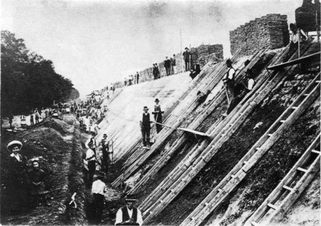 |
| Levee construction, 1908. |
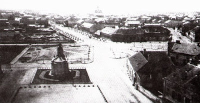
 |
| Szechenyi Square, the main plaza, post-flood |
The new urbanist movement of the 19th century considered narrow winding streets unsanitary, ugly, and undesirable. For two decades preceding the flood, the city already had a master plan in place for the "beatification" of the city mostly consisting of "straightening and widening" its streets and slowly paving muddy streets with brick and stone, the latter which had to be transported from far away by trains due to the complete lack of solid building materials nearby.
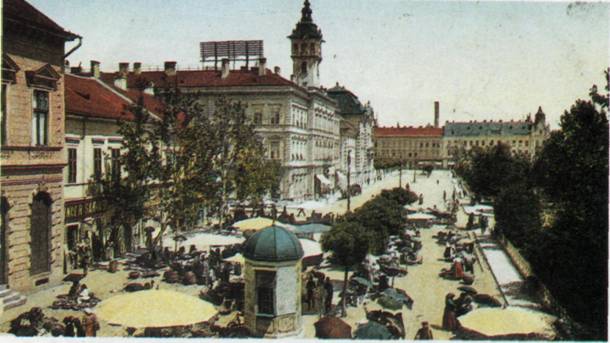
 |
| A new plaza with street car tracks, post-flood Szeged. |
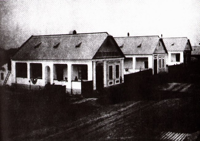 |
| New peasant homes, post-flood. |
Growing up in Szeged, I traveled to many other Hungarian and European cities. I didn't know why every other place I visited had these really neat, cozy, small winding alley like streets.
 |
| Szolnok. |
 |
| Pecs. |
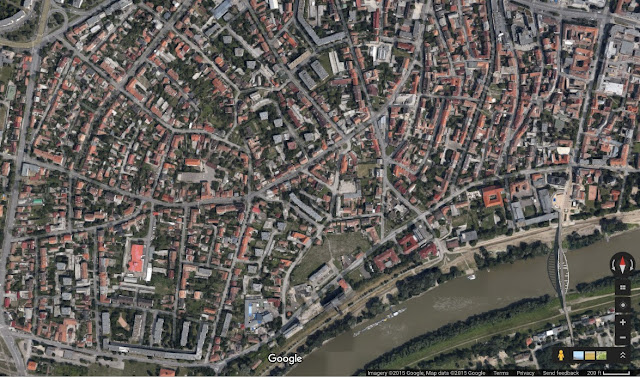
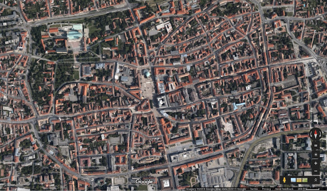
 |
| Szeged. |
The top 2 cities' (Szolnok, Pecs) grids look organic, natural and slightly smaller scale in contrast to the master planned city of Szeged (all satellite images captured at the same scale).
 |
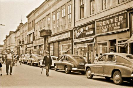
| Karasz street, pre-flood. |
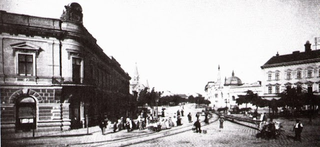
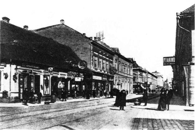 |
| Karasz street, the main central business street, post-flood. Notice the raised curbs of the relatively narrow pedestrian sidewalks and the street car tracks in the center (circa 1885). |
 |
| Karasz street today. The uniform paved surface was completed in 2001. |
 |
| Karasz street in the 1960's. Automobiles were later banned. |
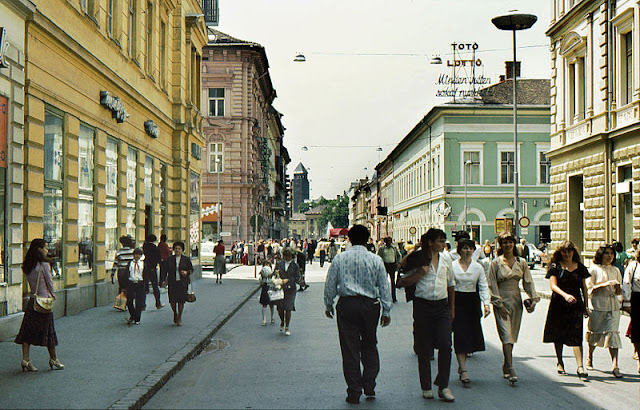 |
| Karasz street, 1981. Cars were permanently banned by then, but the divided surfaces remained until the 21st century. |
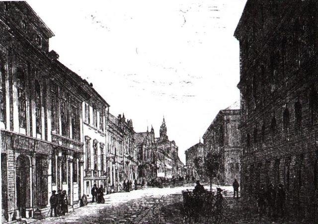 |
| A street, pre-flood. |
Streetcars
The history of the Hungarian streetcar started in Budapest in1887, and today's Hungarian capital has an extensive network criss crossing the city. Today, only 3 of the provincial cities still operate electric streetcars. The city of Miskolc opened its first line in 1897 and is currently operating 2 lines on a total of 14 km length. The city of Debrecen opened its streetcar service in 1911 and is running 2 lines on a total of 19km today.
The first public transportation system in Szeged began operating in 1857 in the form of horse drawn carriages ("omnibus"). Limited by the extremely poor conditions of the unpaved muddy streets this was replaced by fixed rail after the great flood of 1879. The first fixed-rail system with horse-drawn rail cars started operations on July 1, 1884. A fleet of 12 carriages operated by 20 (later 40) horses transported over 300,000 passengers in 1885. Horses were replaced by electricity, and the first electric streetcar rumbled down the streets of Szeged in 1908.
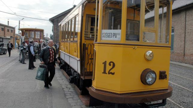 |
| The first electric streetcars in Szeged, restored. |
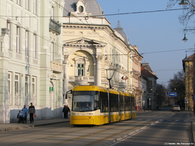 |
| Modern streetcar of contemporary Szeged. |
The original line was 4 km long double rail track that connected the two train stations with speeds of up to 20 kph. Four additional single rail lines expanded the system to a total of 16km in the first decade of the 20th century. Current streetcar lines of Szeged are the largest outside of Budapest, with a total length of 47 km, and carry over 50,000 passengers/day (2008 figure).
 |
| Red: streetcar lines. Blue: trolley bus lines. |
References
http://www.sulinet.hu/oroksegtar/data/telepulesek_ertekei/szeged/szeged_tortenete_3_1/pages/006_szeged_kuzdelme_az_ar_es_belvizek_ellen.htm
http://www.bibl.u-szeged.hu/reizner/index2.html
http://www.szkt.hu/page.fcgi?nyelv=hu


